Even when it appears calm, the sea is never truly silent. Under the surface, the earth shifts and stirs, and - in the blink of an eye - strikes.
The challenge for insurers, homeowners and property owners is not just assessing the aftermath of tsunami events, but actively understanding the risks and taking steps to prepare for what might come, protecting lives and investments by purchasing the right insurance, safeguarding properties, and creating clear escape plans. The potential fallout of a tsunami goes far beyond property damage—it’s about ensuring safety and resilience in the face of disaster.
I learned a valuable lesson about tsunamis when I visited Lisbon, a city nearly destroyed by a devastating earthquake and tsunami in 1755. The disaster wiped out a massive chunk of Lisbon’s population and infrastructure - roughly 85% percent of Lisbon's buildings were destroyed and about of a quarter of the people lost their lives. Waves as high as 65 feet battered the coastline, breaching the city walls of nearby towns.

Learning about this cataclysmic event was a stark reminder that these disasters aren’t just historical footnotes, and that preparation and understanding is key to prevent loss.
For information on building codes and hazard maps, and how WSRB can help you better assess tsunami risk, click here.
A long shadow: the 1700 Cascadia Earthquake
History sometimes offers a window into the future…
For the Pacific Northwest, tsunami risk is a real and imminent threat, one that must be addressed proactively. Washington sits on the edge of a tectonic fault line, a geological handshake between the Juan de Fuca and North American plates, known as the Cascadia Subduction Zone. It’s here, deep within the earth’s crust, that the potential for an earthquake exceeding 9.0 magnitude looms large.1
55 years before the destruction of Lisbon, on January 26, 1700, the Cascadia Subduction Zone ruptured and generated what current scientific conjecture asserts was an estimated 8.7-9.2 magnitude earthquake. The resulting tsunami crashed onto the Pacific coast, flooding native villages and sending shockwaves across the ocean to Japan.2
Though no written records from local indigenous groups exist, oral traditions contain powerful accounts. Native coastal peoples from British Columbia to Northern California share stories of a great upheaval, a devastating shaking of the earth followed by a gigantic wave that engulfed their settlements.
A recurring motif - the thunderbird and the whale – is seen by many scholars as a metaphor for the clash of land and sea, echoing the catastrophic power of a tsunami.
A struggle ensued; the ocean receded and rose again.
Many canoes were flung into trees and many people were killed.
- Quileute Story
The stories are more than legends; they are cultural signposts of a time when the earth shifted violently and reshaped the world.
The tsunami left its mark both locally and globally, and experts today expect a similar event to happen again —maybe tomorrow or in another 300 years, but it will happen.3 A quake of this magnitude could generate waves that would flood coastal cities and towns, reaching as far inland as Puget Sound. In mere hours, the serene shores of Washington could be submerged, homes and businesses swept away.
In the years since 1700, Washington has experienced several smaller tsunami incidents. Learn more about the local history of tsunamis.

The silent threat
Tsunamis are dynamic and often misunderstood forces of nature.
These colossal waves can be triggered by undersea earthquakes, volcanic eruptions, or even landslides. In Washington’s case, the Cascadia Subduction Zone is the primary culprit: tectonic plates colliding with enormous force, causing one plate to dive beneath another.

Subduction can cause the seafloor to shift abruptly, displacing massive amounts of water: the beginning of a tsunami. These massive waves can travel across the ocean at speeds up to 500 miles per hour, unnoticed by ships at sea, and rising into towering walls of water as they approach shallow coastal areas.
A tsunami’s surge brings with it incredible destructive force - rapid, unstoppable, and often occurring in multiple waves. The first wave might only seem like a sudden high tide; however, it’s often a precursor to larger, more powerful waves that can continue their onslaught for hours. This delayed, staggered attack can devastate unprepared communities.
If you want to learn more about the intricacies of tsunami dynamics, check out the fantastic resources provided by the Washington Department of Natural Resources (DNR) – just be careful; you could spend hours looking through this stuff!
From an insurance perspective, the invisible threat posed by tsunamis requires a precise understanding. While the immediate damage is to infrastructure, the long-term financial fallout is far-reaching, making it critical to assess not only the coastline but also nearby waterways and low-lying areas. In the case of Washington, even seemingly protected areas like Seattle and Olympia are susceptible to inundation.

Learn more about localized tsunami risk on the west coast with FEMA’s Tsunami Risk Map.
Building codes and hazard maps
Building codes are a frontline defense in the management of tsunami risk.
In Washington, structures in tsunami-prone areas must meet specific design standards. The Washington State DNR plays a critical role in determining these standards, utilizing advanced modeling to create Tsunami Design Zone Maps.
Washington’s adoption of the 2018 and 2021 International Building Code (IBC) included amendments that require designers, engineers, and architects to use the Washington Tsunami Design Zone (WA-TDZ) maps, where available, to determine if buildings and structures in certain high-risk categories (Risk Categories III and IV) need to be designed to withstand the impacts of a tsunami. These maps provide critical data for determining whether a structure is in a tsunami hazard zone, and they guide the design process to ensure that buildings can withstand the forces that come with a tsunami event.
The rationale behind the creation of the WA-TDZ maps lies in protecting essential infrastructure and minimizing loss of life during extreme events. Buildings in Risk Categories III (such as schools and hospitals) and IV (critical infrastructure, including fire stations and emergency shelters) must meet the strictest standards to ensure that they remain operational in the aftermath of a tsunami.4 The WA-TDZ maps offer site-specific data on tsunami inundation depth, flow velocity, and the maximum considered tsunami for coastal regions and tidally influenced rivers.
These maps are based on probabilistic tsunami hazard analysis, enabling designers to use this data in determining how high the water is expected to rise (inundation depth) and the speed of the water as it hits the structure (flow velocity). This helps ensure that new buildings are designed to resist these forces, an approach vital for locations along Washington’s outer coast, Puget Sound, and the Columbia River where tsunami risk is significant. Sadly, most buildings are not new and were not designed with these forces in mind, leaving many structures vulnerable to the immense power of a tsunami.
In simple terms, the WA-TDZ maps guide builders in determining whether a site is located within a tsunami design zone and whether special tsunami-resistant features are necessary. For example, a school located in a tsunami design zone must be built to withstand not only the shaking of an earthquake but also the subsequent flooding from a tsunami. These stringent building standards are crucial to protecting lives and ensuring the continuity of essential services during disasters.
Each of these zones offers a wealth of data for insurers, giving them insight into both the immediate and long-term risks for properties, whether they be residential, commercial, or industrial. The building codes informed by these maps ensure that structures have a chance to survive a tsunami's force, protecting lives and reducing financial losses. These standards are continuously updated as more data is collected, ensuring that Washington State remains ahead of potential disasters.
Tools for assessing tsunami risk
Delving into building codes and hazard maps can be time-consuming, but WSRB simplifies this process with all-in-one lookup tools that make evaluating tsunami risk easier and faster.

WSRB’s Single-Address Protection Report provides WSRB Subscribers with a deep dive into these factors, combining geographic, structural, and hazard-specific data. If you need help accessing our Protection tool, check out our Help Center article on the topic.
Additionally, using tools like SlopeScout, insurers can assess not only the location but the topography around a building, which plays a key role in tsunami risk. Buildings situated on flat, low-lying land are at greater risk than those on elevated terrain, and SlopeScout allows for quick analysis of these critical factors. WSRB Subscribers can access SlopeScout here.
Preparation
Finally, no tsunami preparedness discussion would be complete without focusing on preparation. Insurers not only need to understand the risks but also guide their clients—whether homeowners, business owners, or developers—toward readiness. Here are some resources you can provide to your customers:
Tsunami Evacuation Maps:
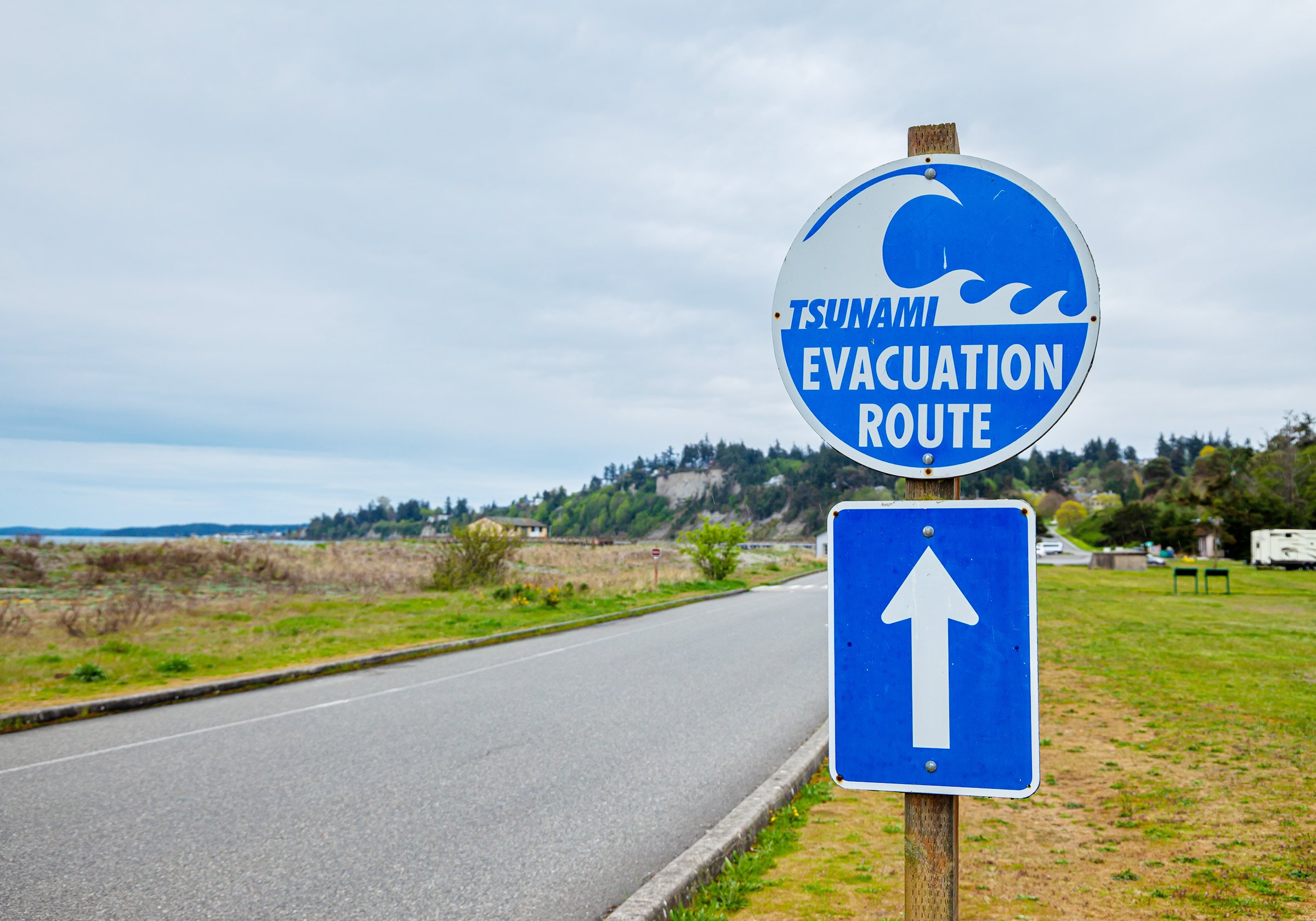
Ensure customers know the safest evacuation routes and high-ground locations. These maps can be found on the Washington State Department of Natural Resources website.
Tsunami Hazard Maps:
Provide information on whether properties are located in high-risk zones and guidance on preparing accordingly.5
Seattle Fault:
Cascadia Fault:
- Olympic Peninsula
- Puget Sound
- Anacortes and Bellingham
- Port Angeles and Port Townsend
- Southern WA Coast
- San Juan Islands
Tacoma Fault:
FEMA Flood Insurance Information:
Direct customers to purchase or review their flood insurance policies, as most homeowner policies do not cover flood damage. Visit FEMA’s National Flood Insurance Program.
Tsunami Preparedness Checklist:
Share a checklist of steps homeowners and business owners should take to prepare for a tsunami, including securing important documents, creating an emergency kit, and developing a family communication plan.
NOAA Tsunami Warning Center:
Encourage customers to sign up for NOAA’s tsunami alerts to stay informed about incoming threats.
[1] Wikipedia, https://en.wikipedia.org/wiki/Cascadia_subduction_zone
[2] Wikipedia, https://en.wikipedia.org/wiki/1700_Cascadia_earthquake
[3] Seismological Society of America, https://www.seismosoc.org/news/how-often-do-cascadias-megaquakes-occur/
[4] Washington State Building Code, https://sbcc.wa.gov/
[5] Washington Military Department, https://mil.wa.gov/tsunami-resources


