It has now been a little more than twenty years since the Nisqually Earthquake caused between $1 and $3 billion in damages throughout Western Washington.1 Yet almost 90% of homeowners in Washington state are not insured for earthquake damage.2 Now is the time to encourage your customers to protect their homes and to reduce your risk of errors and omissions claims. We have exciting news about how you can do both.
It’s now much easier for you to identify which of your customers are at the highest risk of potential damage, reach out to them and help them to add the coverage they need.
A faster, easier way to market earthquake coverage
You can now quickly pinpoint your at-risk customers by getting individualized earthquake property risk data for your entire book of business all at once with our optional Earthquake Risk Book Review. You’ll see all the data available from QuakeScout in a single, easy-to-use spreadsheet. No more looking up addresses one at a time.
Opt for a book review, and you’ll also get all the marketing tools you will need to educate your customers about their risk and encourage them to purchase coverage. To access this program, simply contact us for more information and for pricing details. If you’d like to try looking up individual addresses with QuakeScout, free for WSRB Subscribers, find instructions for using the tool here.
Share this content with your customers today
To help you assist your customers immediately, we’ve collected some of our most useful content that addresses common misconceptions about earthquake risk.
Short video exploring earthquake risk in Washington State
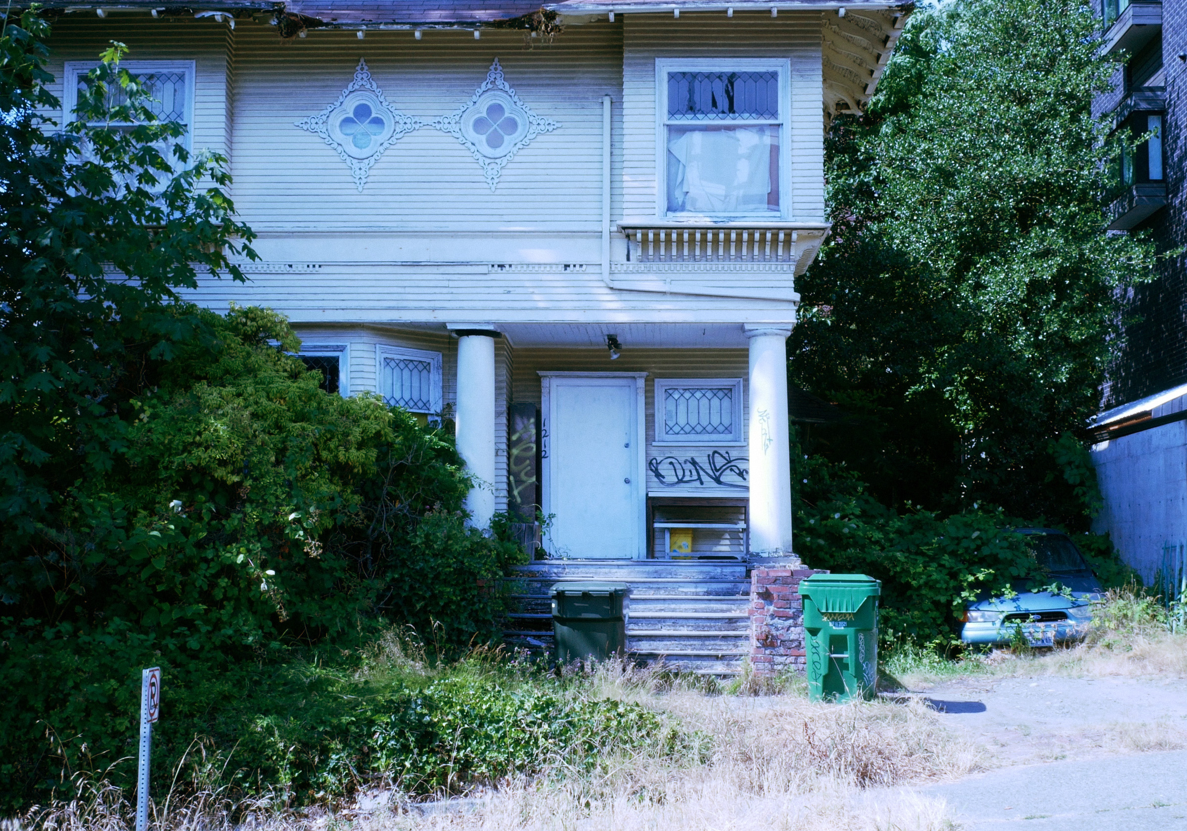
For example, your customers may believe their homes are relatively safe because they don’t live close to a fault line, but the Nisqually quake reminded us that distance to fault line is just one predictor of potential earthquake damage. Movement along the Juan de Fuca plate, which is located off the coast of Washington,3 caused the Nisqually quake, which had its epicenter near Olympia.4 Yet buildings in Seattle’s Pioneer Square crumbled, despite being many miles from the plate or epicenter.5
Or, your customers may know they live close to a fault line but not know about other risk factors and how those factors affect their property. There are four key earthquake-related hazards for properties in the state, according to a Washington State Department of Natural Resources (DNR) guide for homeowners (PDF):
- Ground shaking
- Liquefaction
- Ground failures and landslides
- Tsunamis
We’ve published content on all these hazards, and you can quickly and easily send information from the links below to your customers to help them understand these hazards. For example, the Modified Mercalli Intensity (MMI) Scale predicts ground shaking severity caused by earthquakes. Liquefaction — when the soil under a property liquefies and acts like quicksand during an earthquake — is estimated with liquefaction susceptibility.
Learn more about MMI, liquefaction susceptibility, lahar presence (a key predictor of a landslide caused by an earthquake), and tsunami risk from our blog posts.
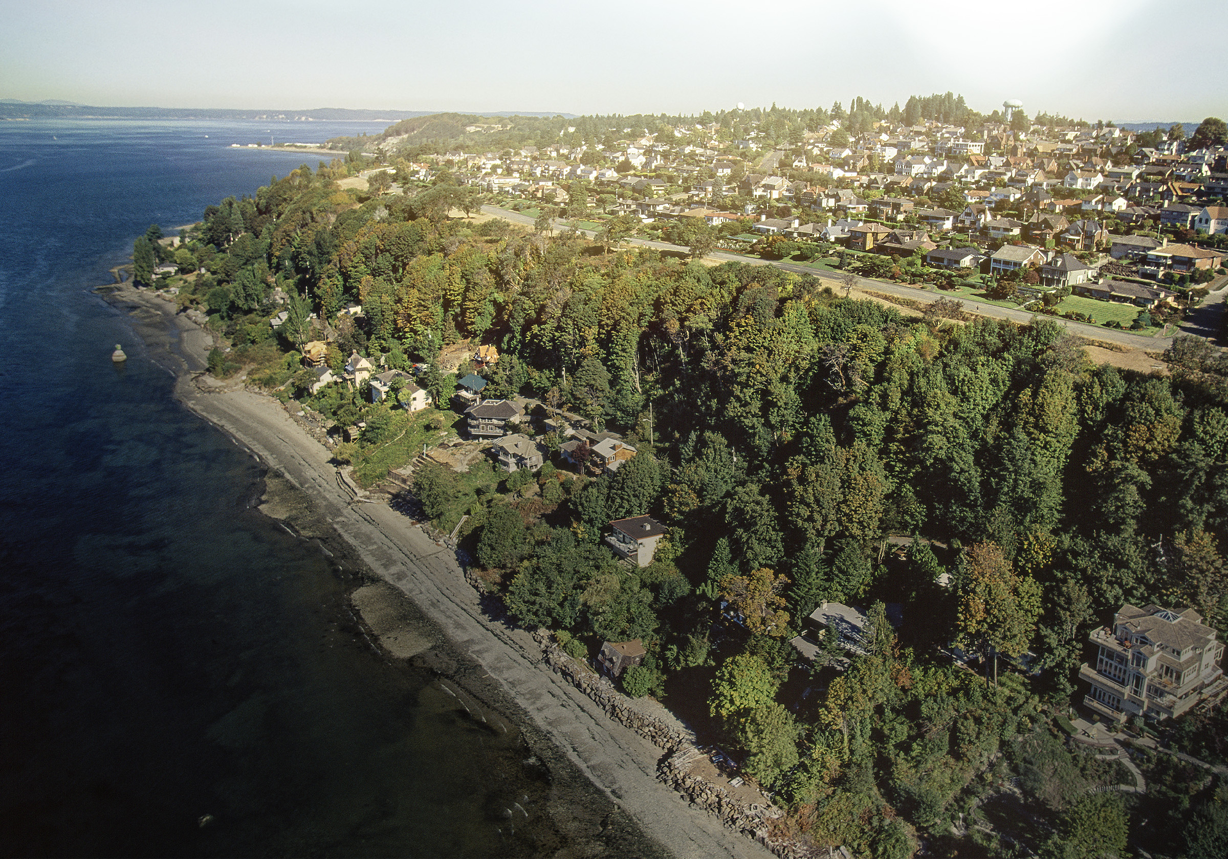
 Many factors, not just distance to fault line, affect the potential for an earthquake
to cause severe damage to a home.
Related:
Do You Know Your Earthquake Classifications for Buildings?
To Educate Customers about Earthquake Risk, Look Beyond Fault Lines
To give your customers a more complete estimate of their property’s earthquake risk, start with this post, which explains why distance to fault line is just the beginning for assessing risk and gives the basics on MMI, liquefaction susceptibility, tsunami risk, and lahar presence.
A Closer Look at Earthquake Risk in Washington State
Get an in-depth look at the risk of an earthquake rattling Western Washington from a University of Washington seismologist. Discover unique characteristics of the area that affect earthquake risk and the potential for property damage.
The Modified Mercalli Intensity Scale for Earthquake Insurance Underwriting
The Richter scale, the most familiar measure of an earthquake’s strength, is limited when it comes to assessing potential property risk. The MMI, on the other hand, was designed to measure shaking severity, and its measurements relate directly to what people feel and how much damage is expected to affect buildings. Discover how the MMI can help your customers understand what could happen to their homes when an earthquake hits.
What Property Insurance Professionals Need to Know about Soil Liquefaction
Liquefaction can severely damage or destroy buildings, even those that are miles from where the most significant shaking occurs. In fact, the Nisqually quake led to liquefaction damage as far as 50 miles from the epicenter. Liquefaction susceptibility can vary significantly within a small area, in some cases from block to block, making it extremely important for each of your customers to see individualized data.
Tsunami Risk: The Thunderbird and The Whale
From an insurance perspective, the invisible threat posed by tsunamis requires a precise understanding. While the immediate damage is to infrastructure, the long-term financial fallout is far-reaching, making it critical to assess not only the coastline but also nearby waterways and low-lying areas. In the case of Washington, even seemingly protected areas like Seattle and Olympia are susceptible to inundation.
We selected these articles because they’re so relevant to helping you educate your customers. But these aren’t the only articles available to help you and your customers understand earthquake-related property risk. Explore all our earthquake blog content here.
Do you have suggestions for how we can improve QuakeScout? If so, contact us so we can get in touch and hear your ideas.

[1] Seattle Post-Intelligencer, https://www.seattlepi.com/local/seattle-history/article/Nisqually-earthquake-18-year-Seattle-magnitude-6-8-13653074.php
[2] The Seattle Times, https://www.seattletimes.com/seattle-news/science/survey-finds-only-11-3-of-washington-homes-have-earthquake-insurance/
[3] U.S. Geological Survey, https://www.usgs.gov/media/images/subduction-juan-de-fuca-plate-beneath-north-american-pla
[4] Wikipedia, https://en.wikipedia.org/wiki/2001_Nisqually_earthquake
[5] History Link, https://historylink.org/File/3039